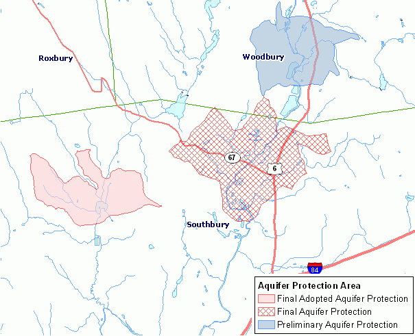
An aquifer protection area is categorized as either a preliminary (level B) or final (level A) aquifer protection area, depending on the quality of mapping. Preliminary mapping provides a general estimate of the area contributing ground water to the well field. Final mapping is based on extensive, site-specific, detailed modeling of the ground water flow system at the well field. For a given aquifer protection area, this information includes either the preliminary or more detailed final mapping. Aquifer protection areas are represented as polygon areas and mapped for use at 1:24,000 scale (1 inch = 2,000 feet).
Administered by the Connecticut Department of Energy and Environmental Protection, the Aquifer Protection Program provides primary protection for Connecticut’s high-yield public water supply well fields. The intent of this program is to protect the water supplies by identifying the land areas contributing ground water to the wells through detailed field work and ground-water flow modeling, and then by regulating land use within those areas. Municipalities adopt land use regulations for final aquifer protection areas. For example, land use involving hazardous materials within a designated aquifer protection area is strictly monitored and regulated.
This information does not include protection areas for all public water supply wells in Connecticut. It only includes aquifer protection areas for public water supply wells located in Connecticut that are set in stratified drift and serve a residential population of 1,000 or more. It does not include protection areas for smaller stratified drift public water supply wells that serve less than 1,000 people. And it does not include protection areas for public water supply wells drilled into bedrock. Also, it does not include protection areas located in Connecticut that serve customers out of state.