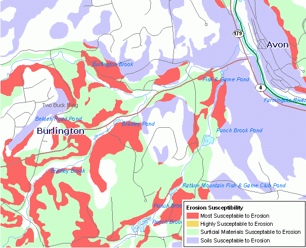
Connecticut Erosion Susceptibility a 1:24,000-scale, polygon feature-based layer that was developed as a predictive tool to show areas most susceptible to terrace escarpment type erosion. The layer compiled from the soils and quaternary geology data layers and was field tested during October-December, 2005. The Erosion Susceptilibity layer was developed as part of Project #03-02 Statewide GIS Analysis and Mapping of the Geologic Conditions Contributing to Eroding Terrace Escarpments. The layer does not represent eroding conditions at any one particular point in time, but rather base or general conditions which can be accounted for during planning or management strategies. The layer includes 4 types of areas susceptible to erosion, ranked 1 (most susceptible) through 4, and their descriptive attribute. Areas outside of the mapped polygons can be considered less susceptible to erosion. Data is compiled at 1:24,000 scale. This data is not updated.
Connecticut Erosion Susceptibility is 1:24,000-scale, polygon feature-based layer that was developed as a predictive tool to show areas most susceptible to terrace escarpment type erosion. This map can be used in conjunction with the 1:24,000 scale Erosion_Sites layer and other documents developed for the Project #03-02: Statewide GIS Analysis and Mapping of the Geologic Conditions Contributing to Eroding Terrace Escarpments. The objective of this project is to identify the geologic conditions that lead to eroding terrace escarpments throughout the state. This layer is part of an information package that can be used as a planning and management tool by state and municipal officials. Not intended for maps printed at map scales greater or more detailed than 1:24,000 scale (1 inch = 2,000 feet.)