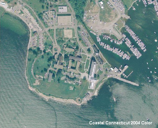
Coastal Connecticut 2004 Color Orthophotography is an aerial survey of 2004, leaf on, true color imagery from the NOAA Coastal Services Center and U.S. Geological Survey for the region encompassed by Connecticut municipalities located along the Long Island Sound coastline. The ground resolution for this imagery is 1.64 feet (0.5 meter) per image pixel.
The 2004 true color orthophotography combines the image characteristics of a photograph with the geometric qualities of a map. This leaf-on, natural color imagery serves a variety of purposes from observing vegetation and crop condition to supporting identification and mapping of habitat areas through photo interpretation. These data have been created as a result of the need for having geospatial data immediately available and easily accessible in order to enhance the capability of the NOAA Coastal Services Center and the U.S. Geological Survey.
This is leaf on orthophotography, therefore the tree canopy blocks the ground surface from view and creates shadows that also obscure nearby features. Also, the location and shape of features in other GIS data may not exactly match information shown in the 2004 aerial photography primarily due to differences in spatial accuracy and data collection dates. For example, a stream in the 1:24,000-scale Connecticut Hydrography data from CT DEP may not line up exactly with the watercourse shown in the 2004 aerial photography. Their location and shape are bound to be different because information such as hydrography compiled from older 1:24,000-scale USGS topographic quadrangle maps, lacks the spatial accuracy and is less current than the 2004 coastal orthophotography.